Hiking the Gibraltar Rock Trail
We stumbled across this trail when taking a drive to Musquodobit and wanted to get out and stretch our legs-all 8 of them-we had the dog with us.
Now, I will freely admit I am not much for hiking converted rail beds, preferring something more woodsy or along the water. So, when we spied the sign for the Gibraltar Rock Trail Loop, we decided it may be fun.
And it was fun. Fun as in up and up and up some more. Over rocks and boulders and roots and along narrow pathways. It’s listed as ‘challenging’ on some websites, ‘moderate’ on others. Let’s just say I was able to climb it fairly easily….but I was out of breath. Really out of breath.The trail is easy to follow and clearly evident with its yellow markers, even so, we managed to get off trail. Once we scrambled a bit higher we spotted the markers again.
This is actually part of the Trans Canada Trail -I think this may be the first time I’ve been on it.
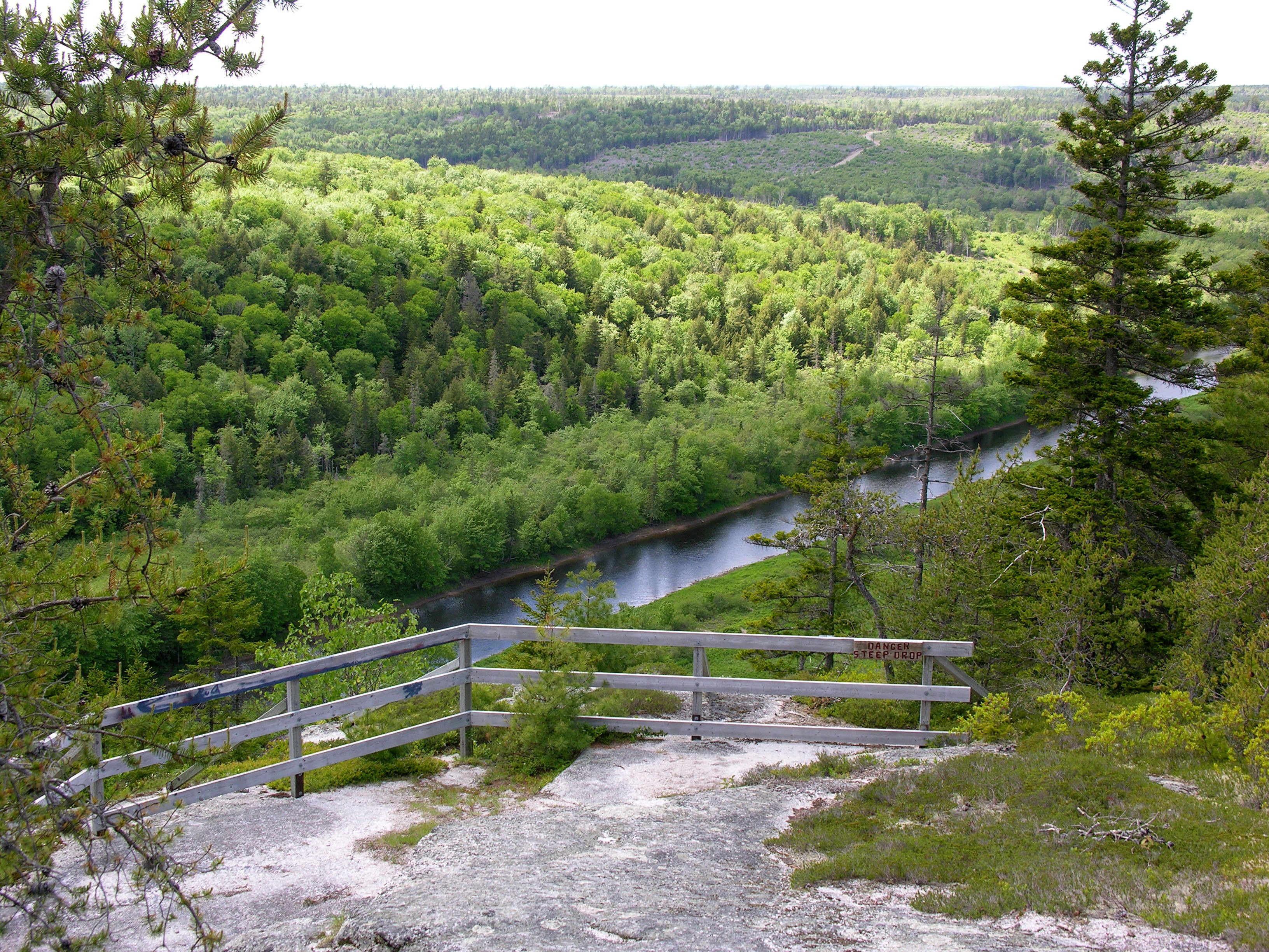
It was worth the climb because the view was gorgeous.


What You Need to Know about the Gibraltar Rock Trail
To find this trail, take Highway 357 north from Musquodoboit Harbour for just over 15 km.The parking lot to the Musquodoboit Trailway is on the right-it’s not big.
Head to the rail trail head and walk only about 100 m and the trail head to Gibraltar Rock Trail is on your left. It’s only less than 1.5 km but you would swear it was longer. It loops around to rejoin the rail trail again-further away from your vehicle, making it about 2.5 km in length.
Great for dogs. Ours loves new trails and she bounded around and up and over boulders and roots , having the time of her life.
Be prepared to climb to an elevation of 144 m. Bring lots of water. Wear good shoes, rocks can be slippery.
Not good for strollers or accessible in any way, shape or form. Stick to the rail trail.
Remember, what goes up, must come down and sometimes that is harder.
There are no facilities at on that part of the trail-bring some tissue.


